|
|
|
|
|
|


2018 Orienteering USA
Nationals
Race Details
Director: Mike Minium Registrar: Guy Olsen
Maps
Friday
Middle and Sunday Long maps will be 1:10,000 scale. The Saturday sprint maps will be at 1:5000 scale. Sunday
long course – Brown A ONLY will be printed at 1:7500.
Courses
All
standard USA courses and classes will be offered.
Course Length (km) and Climb (m)
Table (subject to
change – revision Oct-10-2018)
|
Course |
Friday –
St Patrick’s – Middle Dist. 1:10,000 2.5 m
contours |
Saturday
– Centennial Park – Sprint 1 1:5000 2.5 m
contours |
Saturday
– Centennial – Sprint 2 1:5000 2.5 m
contours |
Sunday –
Bishop Lake – Long 1:10,000 3 m
contours |
|
1 White |
2.3
km, 25 m |
1.4
km, 15 m |
1.8
km, 15 m |
3.0
km, 80 m |
|
2 Yellow |
3.2
km, 35 m |
1.9
km, 15 m |
2.3
km, 25 m |
3.4
km, 85 m |
|
3 Orange |
4.0
km, 45 m |
2.3
km, 25 m |
2.5
km, 40 m |
4.4
km, 135 m |
|
4 Brown A F 65+, F
70+, M 70+, F Brown, M Brown, all 75+ classes |
2.6
km, 35 m |
1.5
km, 20 m |
1.8
km, 30 m |
3.9
km, 105 m 1:7500 scale 4 Brown A Sunday only |
|
5 Brown B F-18, F
55+, F60+, M 65+ |
2.7
km, 40 m |
1.6
km, 25 m |
1.9
km, 35 m |
4.9
km, 150 m |
|
6 Green A F 35+, F
40+, F 45+, F 50+, M 60+, F Green, M Green |
3.6
km, 25 m |
1.9 km,
20 m |
2.1
km, 40 m |
6.5
km, 210 m |
|
7 Green B F-20,
M-18, M 50+, M 55+ |
3.9
km, 40 m |
2.1
km, 30 m |
2.2
km, 40 m |
6.8
km, 240 m |
|
8 Red |
4.6
km, 45 m |
2.3
km, 40 m |
2.6
km, 45 m |
8.9
km, 300 m |
|
9 Blue |
5.2
km, 60 m |
2.7
km, 40 m |
2.9
km, 50 m |
11.9
km, 400 m |
Control Descriptions
Control
descriptions are printed on your map.
Loose description sheets may be picked up when you enter the call-up
area 2-3 minutes before your start.
Descriptions for white and yellow courses are in English only. Descriptions for orange course and above are
in IOF symbols only (ISCD2004).
Control Markers
Control
markers will be IOF standard orange and white flag. Control markers will have a blue stripe,
either diagonal or vertical.
Start Procedures
Clear and
check your SI card when you arrive in the start area.
You will be
called up 3 minutes before your scheduled start.
2 minutes
before your start, you will move forward and may pick up loose control
descriptions.
1 minute
before your start, you will move forward to the map line. You may mark your name / number on the back
of the map. Do not look at your
map. You may ask the starter to check
that it is the correct course.
When the
beeper sounds, you punch “start” and pick up your map.
There may
be a short streamered run to the start triangle shown
on your map (to be determined). You must
run to the triangle. There is a flag but
no punch at this point. At this point
you may begin navigating to your first control.
Drinking Water on
Courses
There will be at least one control
with drinking water on all middle and long courses of orange length and
above. Please use the cups provided and
dispose of them in the bag or bin provided.
Time Limits
Time limit
will be 2 hours for Middle Distance (Friday), 1 hour for each sprint (Saturday)
and 3 hours for Long Distance (Saturday)
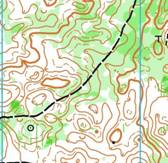
Friday, Oct 19 – St Patrick’s Park,
South Bend, Indiana
Middle Distance
Scale 1:10,000, Contours 2.5 meters
Maps will be printed on 8.5 x 14
paper, portrait.
Course Setter: Mike Minium
Vetters:
Thurston and Bonnie Miller
Consultant: Jonas Kjall
Park entrance fee: Fee waived.
Tell the person at the gate that you are orienteering.
Walk to Start: Event Center, Check-in, and restrooms are
100-300 m flat road walk south of the parking areas; Starts are 100-400 m flat
road walk north of the parking areas.
Toilets: Indoor toilets will be
available near the event center / finish.
Notes: All courses will visit 2 states, using St
Patrick’s Park in Indiana and adjacent Madeline Bertrand Park in Michigan. The parks have a wide variety of terrain including
forests, prairie areas, open park land, riverside floodplains and more. There are many trails and cultural features.
While there are areas of very open
woods, you should also expect to encounter poison ivy and multiflora
rose. We’ve avoided the thickest areas
of the park. In general, rough open
fields have gotten rougher than originally mapped. Fall hasn’t really arrived yet and the weeds
are still pretty tall in many places.
Fences mapped as uncrossable
are difficult and dangerous to cross. They
are 2 meter tall chain link, with an unfinished top edge which is very sharp
and jagged.
Be courteous to other park
users. Many courses will cross a disc
golf course. The park is popular with
hikers. Organizers of a 24 hour trail
running race that begins on Saturday will be setting up streamers and trail
markers for their race, and many racers may be arriving to camp overnight in
the park. They will also be setting up
their registration / headquarters in a shelter building adjacent to our start.
The St. Joseph River, along the west
edge of the map is deep and swift flowing.
Take heed on trails near the edge.
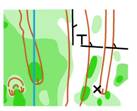
Saturday, Oct. 20 – Centennial Park,
Plymouth, Indiana
Sprint Distance, 2 stages
Scale: 1:5000, Contours 2.5 meters.
Maps will be printed on 8.5 x 11 paper.
Course Setter: Mike Minium
Vetter: Thurston and Bonnie Miller
Consultant: Jonas Kjall
Park entrance fee: None
Walk to Start: 500-800 meters flat
road walk to each start from the event center.
Event Center / Arena is 200-400 meters from
parking.
Toilets: Indoor toilets event
center. No toilets at starts.
Notes: This area is a mix of park
land with many ball fields and other cultural features, school ground, and
forested river bottomland.
All streams are mapped as uncrossable, with dark blue water and black bank
lines. This is a sprint, so that means
DO NOT CROSS. There are several bridges,
and a single ford, mapped with light blue water and blue bank lines. If conditions are dry, the smaller streams
may appear easily wade-able, and the narrowest ones might look tempting to a
very fit long jumper. Remember that the
rule is DO NOT CROSS, (except at the mapped ford) if you cross a stream mapped
as uncrossable, you WILL be disqualified. The largest stream is over your head in many places, do not tempt fate even if you don’t care about being
disqualified.
If conditions are dry, the mapped
ford is less than ankle deep; but when I was there this past weekend (Oct 9),
the ford was swift and muddy, and more than knee deep. If the water is high, we will set up a safety
rope at the ford.
Wooden bridges had wet leaves and
were extremely slippery.
Stairways (sprint 1) are made from
rocks and are uneven and rough.
The first sprint is more park-like
with lots of ball fields and cultural features.
The second is more woodsy with subtle contours
and vegetation. You may encounter
stinging nettles and poison ivy on either sprint!
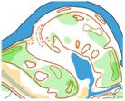
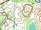 Sunday, Oct. 21 – Bishop Lake, Brighton, Michigan
Long Distance
Scale 1:10,000, Contours 3 meters.
Brown A will be 1:7500
Maps for Brown A, Green B, Red, and
Blue will be 11 x 17 landscape.
All other courses will be 8.5 x 11
portrait.
Course Setter: Igor Guskov
Vetter: Jens Christensen
Consultant: Jonas Kjall
Park entrance fee: There is a $9 per
vehicle fee, usually from self-serve kiosks.
Enforcement is zealous. See the
main event info page for more details.
Walk to Start: 1 kilometer. Allow adequate time.
Toilets: Indoor toilets at event
center
Notes: Bishop Lake features detailed Southern
Michigan glacial terrain with many hills and depressions. more to come...
Travel
and Lodging Information
updated
2018-10-10 1216